|
| DESIGN OF AIR TRAFFIC MANAGEMENT GRAPHICS (EXAMPLE)
This page presents a brief example of how the design process described
on the color graphics design page might
be applied to an Air Traffic Management
(ATM) display. Current upgrade programs are providing more detailed weather information at more locations. New display and communication hardware provide greatly increased display possibilities. New software is being developed to provide computational support for tactical and strategic planning and to reduce communication and display-manipulation demands. Addition of area variables (terrain, weather) and new software tools require substantial changes from traditional ATM graphics to meet legibility, attention management, and color-coding demands. Redesigns of ATM displays are under way at research centers worldwide. Prototype Color Design for an Integrated Display of Hazard Information At the outset we have to emphasize that this example represents just an initial draft of the display and associated user operations. In good design practice every decision regarding the data set to be displayed, the associated user procedures, and the data hierarchy should be initially reviewed by the design team (human factors experts, subject matter experts, and engineering experts) and then re-examined several times during the course of an iterative development process of design/test/redesign/retest. Phase
1: Data Planning Starting
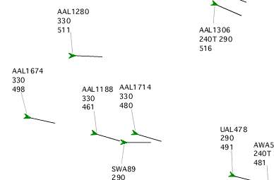
Point. This enroute air traffic controller's
display is based on a NASA
research prototype display
Our
example design here extends the NASA prototype display to include
other hazards. Except for color the existing air traffic and display controls, data,
and graphic coding are kept without modification. The color design for
the pre-existing elements is changed in the new overall color design. Some further data details are derived from consideration of operational constraints. For the weather data, we assume in this example that the intensity categories identified in current airborne radar displays are sufficient for pilots' trajectory decisions, so the 15 levels of NEXRAD are collapsed to four levels that correspond to those in current airborne radar systems. We also assumed for this example that the controller only needs to know the altitudes of the weather to determine whether it is possible to fly above the storm. NEXRAD shows the current position of storm cells, but this is not usually the position of interest to the ATM users. Decisions about trajectories of aircraft are made well in advance, so the weather may have moved or developed appreciably in the time required to fly to it. It's obviously desirable to have accurate predictions of where the storm cells will be and how severe when encountered, with a well-designed graphical depiction of the current and future situations. This is much harder for ATM stations than for the cockpit, where there is only one flightpath to consider. For ATM the controller needs the predicted storm position for whichever of the aircraft are involved in the current planning activity. Since the aircraft and prediction times can vary from moment to moment, this will require some sophisticated graphics. The NASA prototype display includes a "scroll-forward" capability that allows the controller to preview the predicted positions of all the aircraft, based on the software's model predictions. When suitable short-term predictions of storm motion and development are available these predicted motions can be graphically represented in the preview tool. For the current example, the controllers are required to mentally estimate the future location from the current location and motion vector of the cell. |
||||||||||||||
|
||||||||||||||
|
||||||||||||||
|
||||||||||||||
|
||||||||||||||
| Attention Management. The data were sorted into categories and the categories ordered in a hierarchy of urgency. This urgency hierarchy provides the rationale for the graphic design of the display. | ||||||||||||||
The next two categories down are context aircraft and potentially hazardous area variables. The aircraft are passing over, under, or adjacent to the controller's sector and are being worked by the controller of another sector. The weather is currently below "caution" severity. Both categories are dynamic and need occasional monitoring to estimate the likelihood of their becoming a hazard to the controller's aircraft. At the bottom in urgency are static context variables. The lines and symbols delineate boundaries of air traffic control sectors, fixed airways, and navigation fixes, along with the associated text labels. Fixed areas include such things as ATC sectors and restricted-access military airspace. Phase 2: Design
of the Graphics Implementation Design perceptual layers using achromatic color. The first issue was choice of contrast polarity. Traditional ATC displays were "radar-like", with bright symbols on dark backgrounds. In modern ATC settings the display equipment and working environment permit a "map-like" design, with dark symbols on light backgrounds. The second was chosen for this design. The next step was to design achromatic graphics that gave the graphic elements salience that corresponds to the urgency hierarchy, using only non-color graphic variables. In this prototype design only luminance contrast was manipulated for attention control, but font size and stroke width could provide further distinctions.
In this color design, symbols and alphanumeric data for focal aircraft (the ones under the user's immediate control) were assigned high luminance contrast, to give them the highest salience during normal monitoring and planning. Aircraft owned by another controller were given noticeably lower luminance contrast. Context data--lines, symbols, labels, and non-hazard area variables--were coded at low luminance contrasts to give them the least salience without actually removing them. The sector regions were labeled with grayscale shading. That leaves only the urgent data. Since the focal aircraft already had been given high luminance-contrast other graphic variables were needed to give the maximum salience to the urgent data. These aircraft and hazards were made to stand out by use of chromatic color. While not included in this prototype, various degrees of temporal modulation (blinking and flashing) and possibly auditory signals might also be used to further increase the salience of the most extreme, unusual hazards, should they prove necessary. Decide where chromatic color will be used and why. Chromatic color is used sparingly in this prototype, for specific purposes. The most important use is caution-and-warning color codings for the symbols of aircraft in traffic conflicts and for weather. The saturated colors give these high-urgency data still higher salience through "popout" and provide specific, culturally conventional labels. More subtle chromatic color is also used to group classes of aircraft. Static grouping includes groups of aircraft in different phases of flight (arrivals, departures, and overflights). This helps the controllers plan by providing expectations about the aircrews' intentions. Temporary color coding to achieve visual grouping and popout includes color coding of all interface elements that relate to the currently selected flight. The datablock element currently under the cursor is also highlighted. This helps the controller quickly find and integrate all of the information pertaining to the flight under scrutiny. It also aids interaction by identifying targets for possible cursor movements.
|
||||||||||||||
|
||||||||||||||
|
||||||||||||||
|
Choose colors. The color choices were based on a number of considerations. Cultural constraints and standards were considered first in selecting hues and saturations for labeling the hazard data. Warning status and caution status required saturated red and saturated yellow or yellow-orange, respectively. ((Use of magenta for the fourth, most severe weather level is not a broad cultural convention but is incorporated because it corresponds to usage in many cockpit weather displays). The luminance and purity values were chosen on the basis of perceptual layering demands. Very pale green was used for low intensity weather for several reasons. The areas covered by low intensity weather can be quite large, and aircraft often fly through it. Use of a low-saturation green for this level of weather allows high luminance-contrasts with aircraft and other symbols. It also avoids simultaneous- and successive-contrast problems that can occur with large areas of saturated color. Warning-level weather is usually confined to small areas so the relatively low luminance of high-saturation red is a minor problem. Caution-level weather also tends to be small, and maximum purity and high luminance can be gotten simultaneously in yellow. Adjacent sectors were shaded slightly darker than the controller's own sector. The controller's own sector was left white so that it had maximum background brightness and the maximum range of possible luminance-contrasts for data elements. Discriminability and identifiability then became constraints on choices as the hazard labeling reduced the options for other coding colors. Arrivals and departures were labeled in green and blue, respectively, dark enough to preserve the high luminance-contrast required by their position in the urgency hierarchy, but not so dark as to make identification problems. Overflights remain black. Magenta was chosen as the grouping color for the selected aircraft's data elements (not shown in this sample). Highlighting for mouseover status is accomplished by bolding, which produces subjective darkening in this contrast polarity (not shown in this sample). Solve problems. There are several aspects of this design that need testing and possible modification: Current cultural usage and standards require that aircraft in warning status (due to traffic conflict or declared emergency) and hazardous weather both be coded in saturated red. In the presumably infrequent case of a red aircraft being in the middle of red weather the luminance-contrast between aircraft symbol and background will be low. The proposed solution is outlining the aircraft symbol in black. The use of green to label the arrivals also deserves further scrutiny. Cultural usage is that green implies a "safe" condition, i.e., that it has been evaluated and determined to be safe. Arrival traffic often does get extra scrutiny (due to the natural convergence of arrivals as they near the airport), but there may be circumstances in which an aircraft is not currently in caution or warning status but doesn't yet have a conflict-free route in the controller's overall plan. If so, another color might need to be substituted for the dark green, and that choice might require some adjustment of the other colors used for aircraft symbols. The distinction between the two most severe weather categories may not prove justified in practice--aircraft should avoid both whenever possible. In that case only three levels would be used, with red for both of the previous top levels. As the interface
undergoes successive stages of testing these and other problems
may require redesign of part or all of the color scheme. These redesigns
must be done with as much or more care than the initial design, and the
required time and money should be identified at the beginning of the project. Related Topics:
|